Delena, Oregon
Unincorporated community in the state of Oregon, United States
Unincorporated community in Oregon, United States
46°05′54″N 123°04′26″W / 46.09833°N 123.07389°W / 46.09833; -123.0738997016
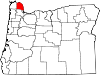
Delena is an unincorporated community in Columbia County, Oregon, United States. It lies along U.S. Route 30 slightly west of Alston and about halfway between Rainier on the east and Clatskanie on the west.[2]
Delena had a post office that operated intermittently from April 22, 1892, to March 15, 1922. Lincoln J. Meserve was the first of nine postmasters at this location.[3]
Accounts of the origin of the community's name have varied, according to Oregon Geographic Names (OGN). It may refer to a mythological name that Meserve found in a book or it may be the name of someone in Meserve's family or it may refer to a place in Nebraska. In 1947, W. N. Meserve, Meserve's brother, told the OGN compiler that the mythological explanation was correct, and the compiler could find no place named Delena in Nebraska.[3]
References
- ^ a b "Delena". Geographic Names Information System. United States Geological Survey. November 28, 1980. Retrieved May 15, 2017.
- ^ Oregon Atlas & Gazetteer (7th ed.). Yarmouth, Maine: DeLorme. 2008. ISBN 0-89933-347-8.
- ^ a b McArthur, Lewis A.; McArthur, Lewis L. (2003) [1928]. Oregon Geographic Names (7th ed.). Portland, Oregon: Oregon Historical Society Press. ISBN 978-0875952772.
- v
- t
- e
Municipalities and communities of Columbia County, Oregon, United States
County seat: St. Helens
unincorporated
communities
- Oregon portal
- United States portal
 | This Columbia County, Oregon state location article is a stub. You can help Wikipedia by expanding it. |
- v
- t
- e


