Weedville, Pennsylvania
Census-designated place in Pennsylvania, United States
41°16′35″N 78°29′30″W / 41.27639°N 78.49167°W / 41.27639; -78.49167 (2020)
15868
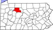
Weedville is an unincorporated community and census-designated place in Jay Township, Elk County, Pennsylvania, United States. As of the 2020 census, the population was 565.[1][2]
Weedville is located in the southern part of Jay Township, in southeastern Elk County, in the valley of the Bennett Branch Sinnemahoning Creek, a tributary of the West Branch Susquehanna River. It is bordered to the northwest by Byrnedale and to the southwest by Force. Pennsylvania Route 255 passes through the community, leading north 12 miles (19 km) to St. Marys and southwest 19 miles (31 km) to DuBois. Pennsylvania Route 555 branches off PA 255 in the center of Weedville, leading northeast, then east, down the Bennett Branch valley 26 miles (42 km) to Driftwood.
References
- v
- t
- e
Municipalities and communities of Elk County, Pennsylvania, United States
County seat: Ridgway
- Byrnedale
- Force
- James City
- Kersey
- Weedville
- Wilcox
communities
- Pennsylvania portal
- United States portal
 | This Elk County, Pennsylvania state location article is a stub. You can help Wikipedia by expanding it. |
- v
- t
- e


